In today’s fast-evolving planning, development and infrastructure landscape, geospatial intelligence is no longer a luxury. It’s a necessity. Ordnance Survey’s NGD Buildings dataset offers essential insights for property, utility and environmental professionals.
For Barbour Product Search readers, mastering this dataset and understanding how its interactions with other NGD layers can help you gain a competitive edge in delivering projects with confidence.
What are OS NGD Buildings?
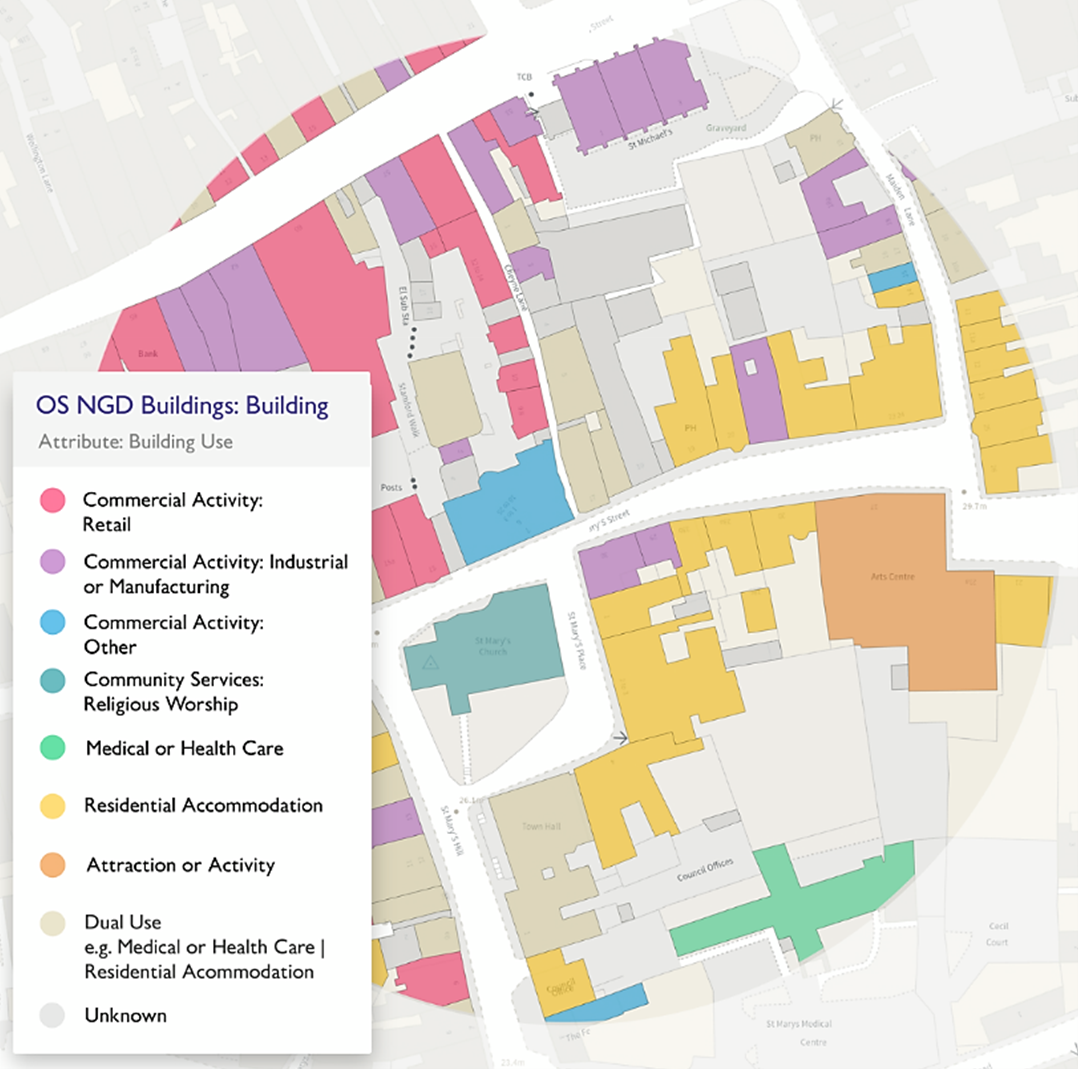
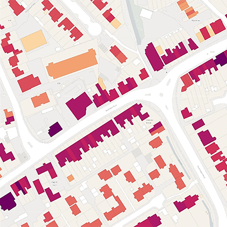
The NGD Buildings layer is an authoritative dataset that captures accurate building footprints across the UK, from both homes to commercial complexes, domestic properties to skyscrapers. Unlike general mapping or parcel based data, NGD Buildings focuses on the building level, offering high resolution, precise outlines and integration ready formats.
While NGD Buildings is central for built environment insight, the broader NGD suite also includes land parcels, topography, transport, utilities and more. These layers, when stitched together, create a comprehensive spatial picture.
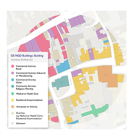
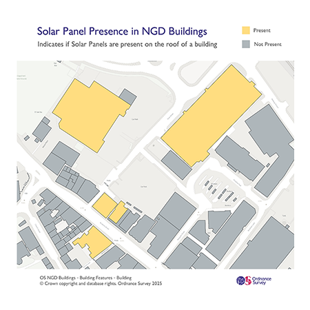
Key Attributes of NGD Buildings
What sets NGD Buildings apart is its attributes, making it exceptionally useful across sectors:
Precise building footprints - actual outlines of every structure: residential, commercial, agricultural and industrial.
Geospatial accuracy & currency - maintained by Ordnance Survey, ensuring reliability in updates.
Integration friendly formats - ready for GIS, CAD and spatial analysis workflows.
Layer compatibility - easily overlaid with other NGD elements (parcels, roads, utilities, elevation).
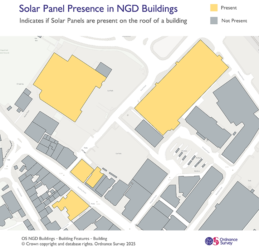
Detailed features - Precise height measurements, building material, construction and number of floors to name a few.
Benefits of NGD Buildings Smarter Planning & Development
With building-level data, planners and developers can make smarter, faster decisions. They can review building layouts and densities to optimise designs and consider key factors like adjacency, orientation, spacing and access. Overlaying this data with NGD parcels and topography allows deeper analysis of constraints such as slopes or nearby land uses. This clarity helps reduce surprises, speed up design changes and make communication with stakeholders easier.
Advanced Risk Analysis
When integrated with environmental datasets, NGD Buildings becomes a powerful tool for risk assessment. Planners can identify buildings that may be at risk of flooding by overlaying relevant flood datasets or evaluate exposure to subsidence and drainage issues by examining terrain and geological data. In addition, mapping clusters of vulnerable buildings supports resilience planning and informs insurance coverage decisions, ultimately helping communities and organisations better prepare for environmental challenges.
Cost & Time Efficiencies
Leveraging NGD Buildings delivers significant cost and time savings by reducing the need for redundant field surveys and manual tasks. Since building geometries are already available, teams can limit reliance on expensive on-site data collection and cut down on manual drafting or digitisation. Additionally, providing a single authoritative source of building footprints ensures that all project stakeholders work from consistent, reliable data, helping accelerate workflows and improve coordination across teams.
Regulatory & Compliance Support
NGD Buildings also plays a vital role in helping projects meet regulatory and compliance requirements. Planning applications can be built upon robust and accurate data, while environmental and impact assessments benefit from precise building details. By reducing mapping errors and discrepancies, this minimises unnecessary back and forth with regulators, facilitating smoother approval processes and ensuring projects stay aligned with official standards and expectations.
Applications Across Sectors
Urban & Site Planning
NGD Buildings provides the foundational data that underpins digital 3D models, helping planners master site layout, massing, spacing, solar access, green roofs, shadowing and more. It can be used to model density, transitions and built form scenarios.
Infrastructure & Utilities
By overlaying NGD Buildings with utility networks, teams can gain a comprehensive view of how buildings interact with critical infrastructure. This allows them to identify potential conflicts between structures and utility lines before construction or upgrades, plan efficient delivery and strategically locate service points such as transformers, meters or connection hubs.
In addition, having this integrated view supports the optimisation of maintenance schedules, reduces operational disruptions and helps ensure that utilities are safely and efficiently managed across the site or neighbourhood.
Property & Valuation
Building level data allows precise quantification of built-up areas, individual building footprints and their relative positions to neighbouring structures. This information is essential for property assessment, appraisals and market comparisons, as it helps determine land utilisation, density and spatial relationships. Accurate measurements also support investment analysis, valuation consistency and informed decision making in real estate development and planning.
Emergency Services & Resilience
In emergency planning, NGD Buildings helps design evacuation routes, prioritise vulnerable structures, model fire spread and improve disaster response with its detailed attribute of pedestrian/vehicle access points.
Environmental & Sustainability
Combining building footprints with green infrastructure, tree cover or drainage data supports sustainable growth analysis and low impact design. This integrated approach helps planners assess environmental impacts, manage stormwater effectively, preserve green spaces and design developments that balance urban growth with ecological sustainability.
While building footprints are powerful, their value multiplies when combined with additional NGD attributes. We are looking to introduce various aspects of the NGD dataset to our ordering interface over the coming year. Together, these layers unlock multidimensional insight into any site or region.
If you would like to discuss your individual use case, do give us a call on 01886 832 972. We also have a webinar series starting in March, breaking NGD into bitesize lunchtime learning - you can sign up for these on our website www.centremapslive.co.uk
Harnessing the Power of OS NGD Buildings: Attributes, Benefits, and Applications

| E | info@centremaps.co.uk |
|---|---|
| W | Visit Centremaps Limited's website |
| Open Space, Leigh Sinton Road, Upper Interfields, Malvern, WR14 1UT |
Products by this Company


